
Last modified: 2014-06-28 by klaus-michael schneider
Keywords: sahara-suz | suz | lion | camel | renati-conjuncti-invicti | palm tree | garter |
Links: FOTW homepage |
search |
disclaimer and copyright |
write us |
mirrors

See also:
Siebmacher’s 1876 book [g2h78]
reports «the war flag is white with the (apocryphal) Coat of
Arms» and «the merchant flag additionally
has the English Union [jack] in the canton.»
David Prothero and Jarig Bakker, 22 Jan 2001
When actually were these flags used? 1856-1895?
Nozomi Kariyasu, 16 Mar 2001
I feel that it is not just the Coat of Arms that is apocryphal but possibly both flags. There doesn’t seem to have been any British involvement in the area that would make the flags necessary. Two vague references:
The coat of arms is also described in Vlaggen van alle Natien
[stb62] published in Amsterdam, 1862.
Nozomi Kariyasu, 23 Jan 2001
Soes, Sus, or Souse, Suze — southernmost
province of Morocco, in the past an independent kingdom,
between 28.30 and 30.30 North, and 10 and 14 West, bordering in the north to
Morocco proper, east to the Atlas mountains, south to the Sahara, west to the
Atlantic., c. 400 000 km2 with 700 000 inhabitants. The
river Tesset divides it into Suz-el-Adna, subjected completely to Morocco,
and Suz-el-Asca, with only tributary districts. The main places are: Terodant
or Tarudant, Agadir or Santa Cruz, Tagawost, Tedsi, Messa, Stukka and Nun. Part
of Suz is now comprised into the new state Sidi-Hesjam. (From Kramer’s
Geographisch Woordenboek 1883; translated from the Dutch.)
Jarig Bakker, 27 Jan 2001
The map at www.mincom.gov.ma/french/reg_vil/regions/reg-f.html
shows the province #4 Souss-Massa-Draâ, which is about the northern part of
Sahara-Suz. The southern part of Sahara-Suz on that map is province #3,
Guelmim-Es Smara, at present part of Morocco, but possibly claimed by Western
Sahara. That part, north of and including Cape Juby (with Tarfaya) shows on
old French atlases as part of Spanish Sahara (Saguia Hamra).
Jarig Bakker, 28 Jan 2001
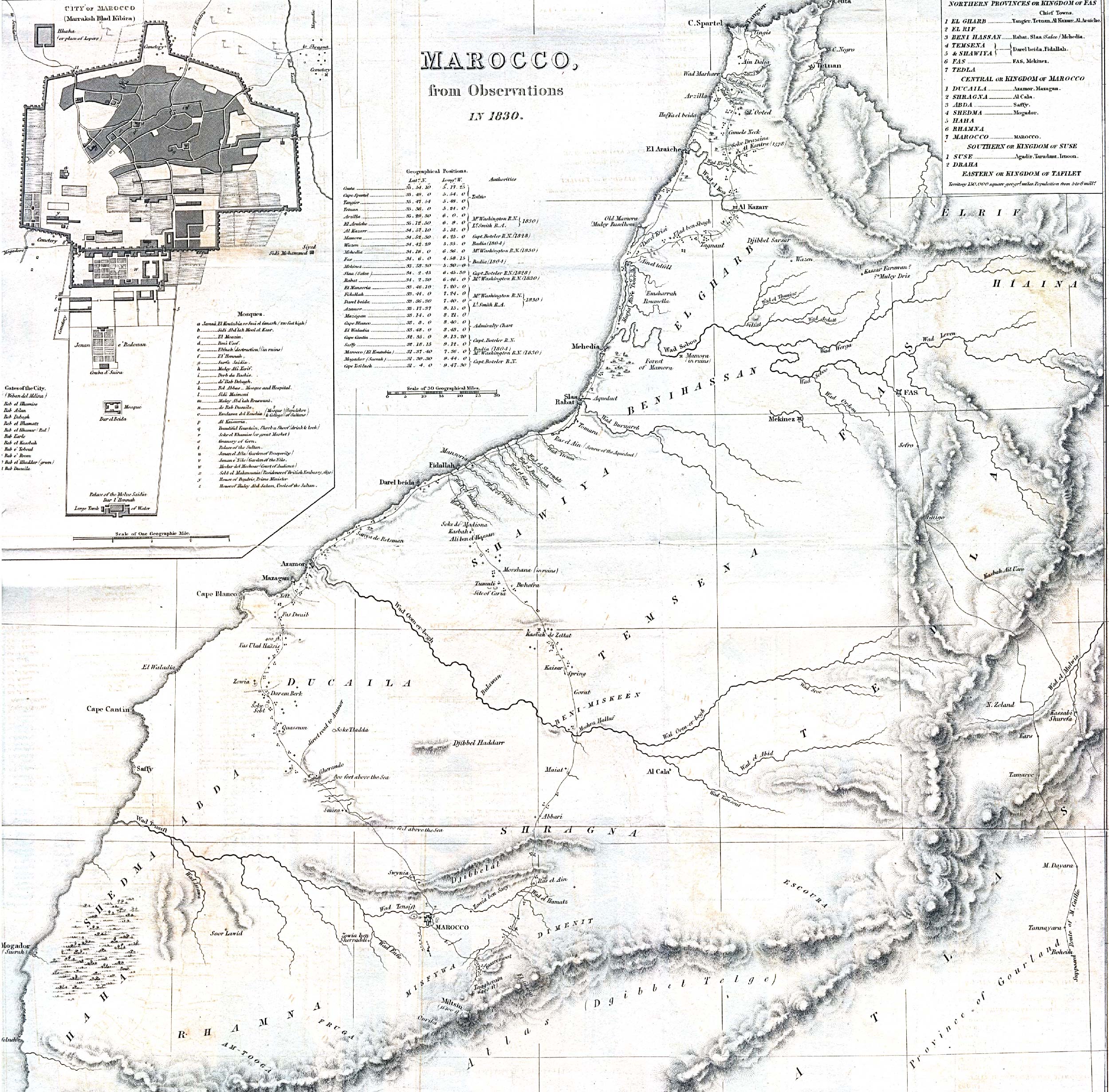
An 1830
map of Morocco (enormous 1362 kB JPG, but does not reach south of Marrakech)
has a legend on the top right corner speaking about three kingdoms, the northern
provinces making up the Kingdom of Fas (i.e. Fez), the central ones that
of Marocco (sic) and the southern ones the Kingdom of Suse (sic). The
latter are the provinces of Suse (for which it gives as chief towns Agadir, Tarudant
and Irnoon) and Draha.
Santiago Dotor, 30 Jan 2001

back to Morocco main page click here