
Last modified: 2025-08-09 by rob raeside
Keywords: big lakes |
Links: FOTW homepage |
search |
disclaimer and copyright |
write us |
mirrors
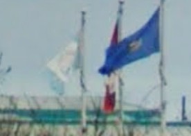
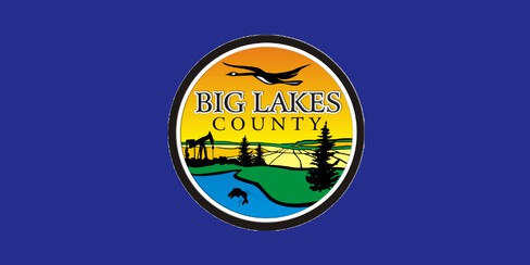 image located by Vanja Poposki, 26 July 2025
based on photo
Municipalities in Big Lakes Municipal District:
See also:
Big Lake, AB has changed to a design based on their new logo, consisting of
their new logo on a blue field
https://www.google.com/maps (2018)
https://biglakescounty.ca/
https://files.catbox.moe/nqlpuq.gif
Eddie Zhang, 11 January 2025
2.gif) image located by Eddie Zhang, 11 January 2025
image located by Eddie Zhang, 11 January 2025
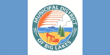 image by Ivan Sache, 22 April 2017
Source: Town of Big Lakes
The flag of the (former) Municipal District of Big Lakes, Alberta, consists of three
vertical stripes green-white-green (Canadian style), with Municipal District logo in the center
of the white stripe.
Valentin Poposki, 12 November 2009
The flag must be obsolete since the County has adopted a new emblem.
http://www.mdbiglakes.ca/ - Official
website
Ivan Sache, 22 April 2017
About the municipal district:
The Municipal District of Big Lakes is a municipal district in north-central Alberta, Canada. It is located in Census Division 17, around the Lesser Slave Lake. Utikuma Lake and Winagami Lake are also located in this municipal district. It has 5,805 residents.. - Source: Wikipedia: Big Lakes, Alberta.
Valentin Poposki, 12 November 2009
The Municipal District of Big Lakes was incorporated on 1 January 1995 from
Improvement District to Municipal District, and renamed to Big Lakes County by
Order in Council No. 76, adopted on 6 March 2015.
http://www.qp.alberta.ca/documents/orders/orders_in_council/2015/315/2015_076.html
The County (4,193 inhabitants; 1,213,056 ha) includes three "major" lakes:
Lesser Slave Lake, Winagami Lake, and Snipe Lake.
Ivan Sache, 22 April 2017