
Last modified: 2024-06-15 by ian macdonald
Keywords: national geographic organization | iran |
Links: FOTW homepage |
search |
disclaimer and copyright |
write us |
mirrors
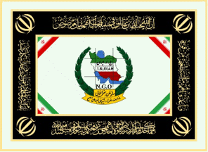 image located by Esteban Rivera, 9
May 2024
image located by Esteban Rivera, 9
May 2024See also:
The Geographical Organization of Armed Forces or National Geographical
Organization of Iran was officially founded in 1951 to prepare maps and survey
geographical activities. Of course, origin of this mapping organization and
formation of surveying and cartography branches was laid in 1921, and in the
course of its evolution, it performed responsibilities in accordance with the
needs, missions and organizational duties. Finally, it is identified as the
National Geographical Organization of Iran or National Geographical Organization
of the Armed Forces of Iran. Currently, the National Geographical Organization
of Iran, along with the National Cartographic Center, conducts affairs related
to surveying and preparation and production of spatial information, but matters
related to military maps, national borders and geographical services required by
the Armed Forces are performed only through the National Geographical
Organization of Iran.
Sources:
http://mod.ir/content/سازمان-جغرافيايي ,
http://www.ngo-iran.ir/moarefi.htm
and
https://fa.wikipedia.org/wiki/
The flag is a white horizontal
background with the logo in the middle.
For additional information go to NGO (official website):
http://www.ngo-iran.ir
NGEO (official
website): https://www.ngeo.gov.ir
Esteban Rivera, 9
May 2024
.gif) images located by Esteban Rivera, 9
May 2024
images located by Esteban Rivera, 9
May 2024
Sources: https://en.wikipedia.org/wiki/National_Geographical_Organization_of_Iran