Last modified: 2026-09-19 by martin karner
Keywords: elkana | mo'atza mekomit elkana | judea and samaria |
Links: FOTW homepage |
search |
disclaimer and copyright |
write us |
mirrors
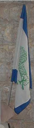
image from <kehilot.moreshet.co.il>
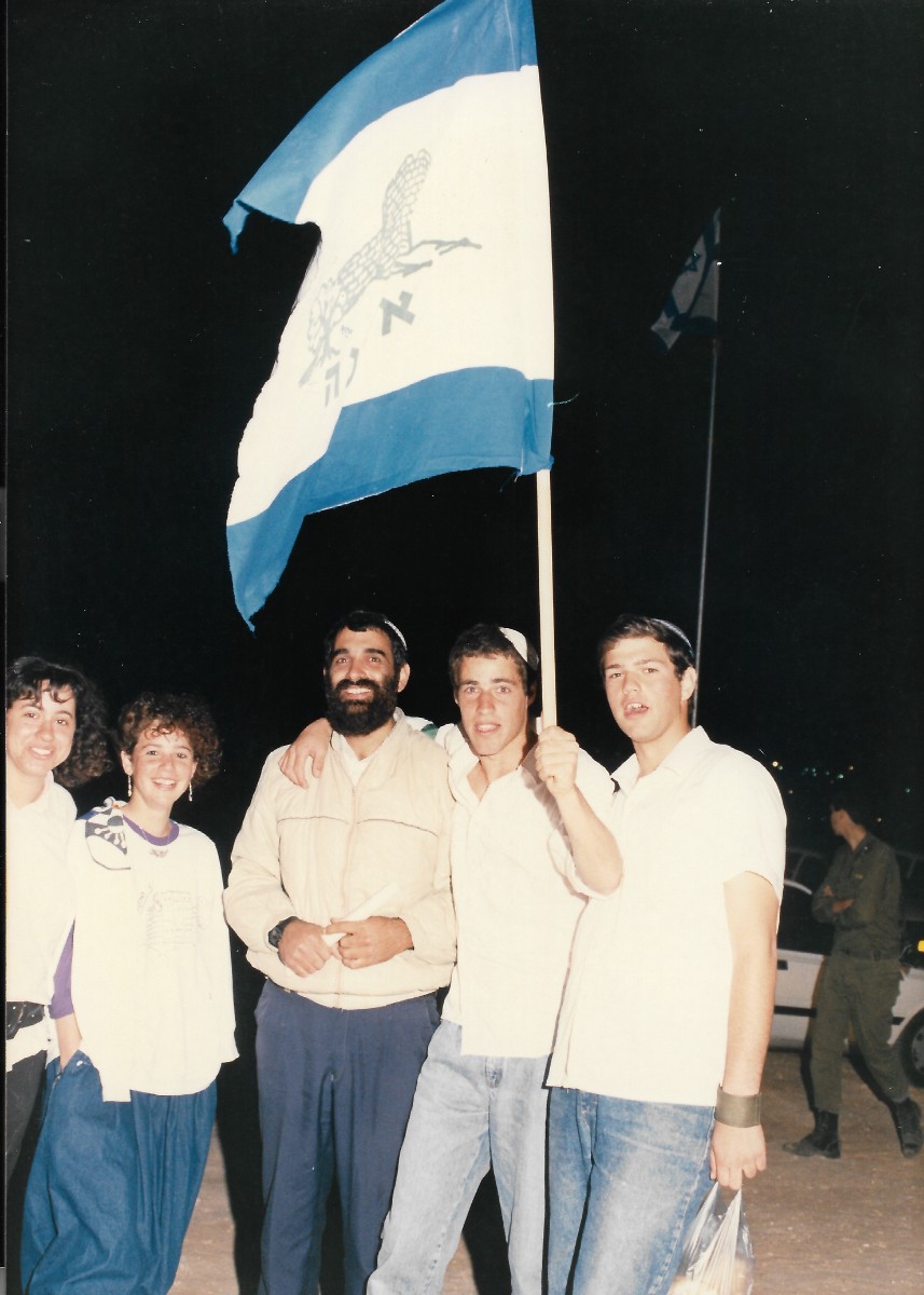
♦ photo source (bar mitzvah, 1990)
See also:
The Local Council Elqana is situated in Judea and Samaria
District, 12 km west of Ariel.
Elqana is named after the father of Samuel the prophet (Samuel A, 1,1
[1 Samuel 1:1]) and was established on
6.5.1977 by Gush Emunim and became a Local Council in 1981.
Most of its 3000 inh. are religious.
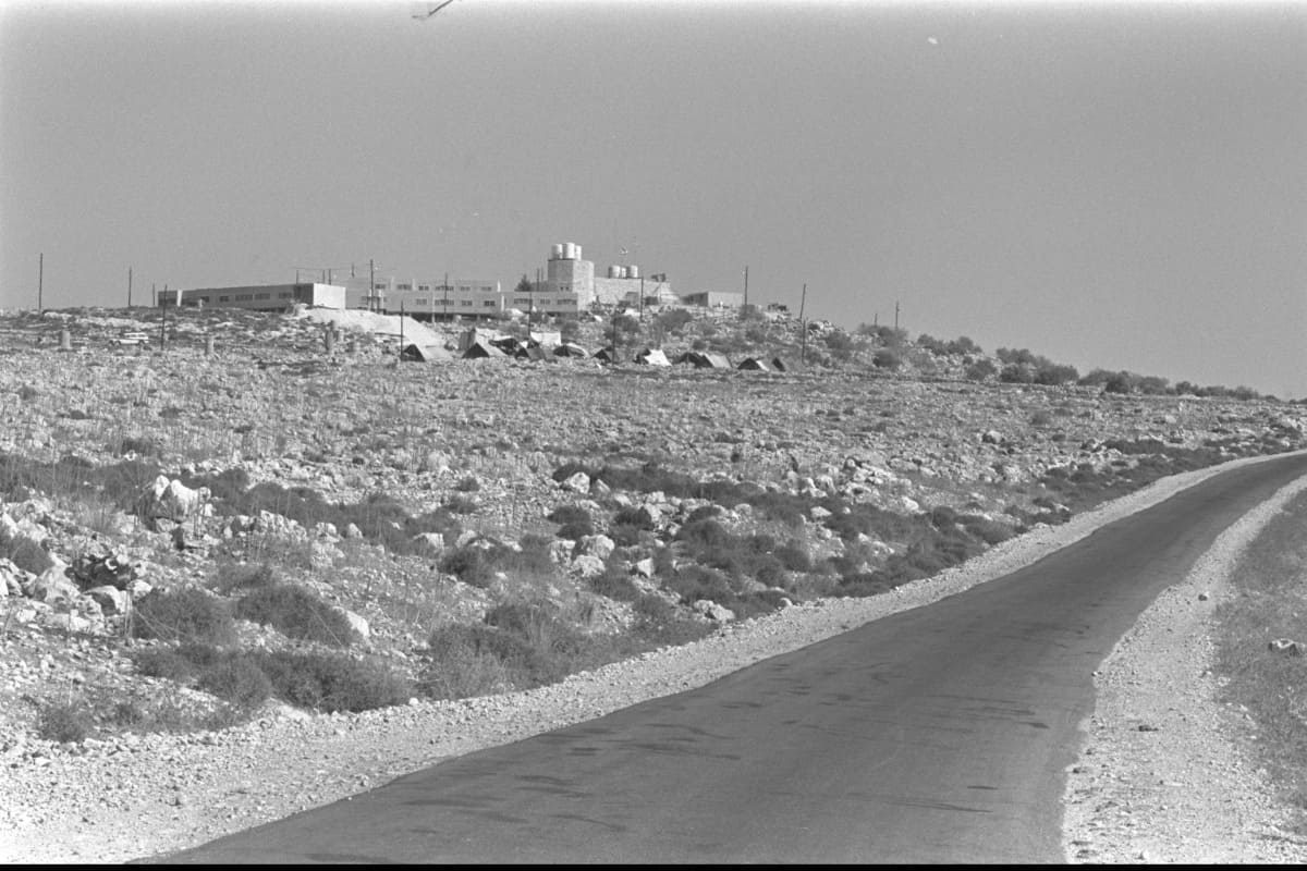
The first settlers settled at Meskha, a former Jordanian
police fort on top on a hill which was used as synagogue, school
and kindergarten and became so significant in the life of the
founders that they choose it to appear in their emblem together
with an olive tree [photo 1977 source].
Today the former fort is used as city hall.
A photo of the municipal flag can be seen at kehilot.moreshet.co.il/elkana/rabin.jpg [not archived]
and http://kehilot.moreshet.co.il/UploadFiles/elkana/photo8.jpg [not archived].
The flag is ∼1:4 horizontal blue-white-blue charged with the
municipal emblem and below it inscription of its name, both in
green.
Source: http://kehilot.moreshet.co.il/web/about/index.asp?id=367 [not archived].
Dov Gutterman, 8 April 2005
.png)
(source)
elqna.jpg)
(source: Wikipedia [expired], former website)
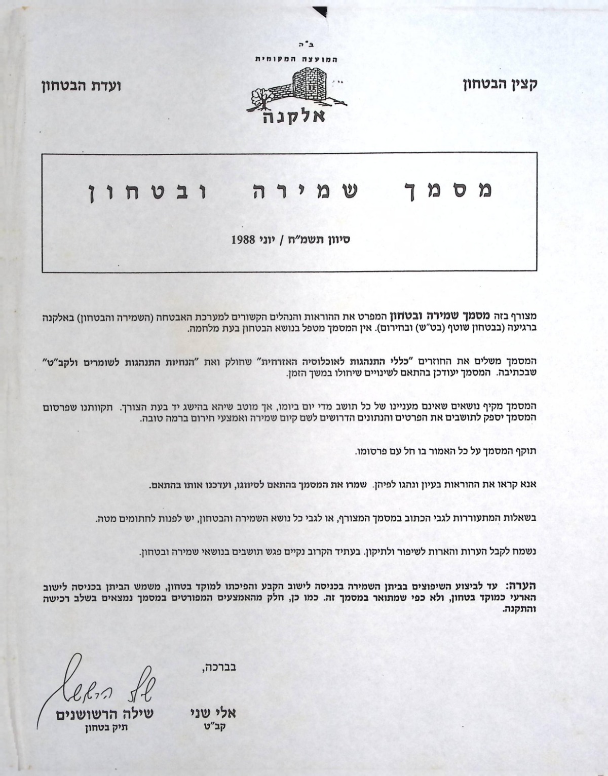
♦ photo source (CoA on a letterhead, 1988)
From the former communal website (in Hebrew):
The former Jordanian police station has been restored and renovated and now serves as the Elkana Local Council building. The town's coat of arms was designed by Mr Zuntz, one of the first settlers, and depicts the police station atop the hill, with an olive tree standing in front of it. The emblem symbolises war and peace, the present and the future, the old and the new, the settlement's connection to the surrounding nature, and the view that met the eyes of the first settlers: an imposing stone building with olive trees.
(Translated with DeepL.com)

2.jpg)