This page is part of © FOTW Flags Of The World website

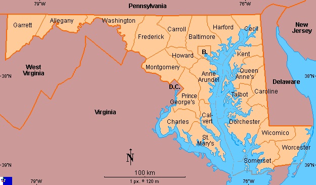
Clickable map of Maryland (United States)

Last modified: 2014-08-02 by rick wyatt
Keywords: maryland |
Links: FOTW homepage | search | disclaimer and copyright | write us | mirrors


See also:

Copyright: FOTW Maryland map by António Martins and boundaries’ data by Michael Smuda. If you wish to reuse them on your website, read our copyright rules.

Pennsylvania New Jersey Queen Anne's County, Maryland Caroline County, Maryland District of Columbia Prince George's County, Maryland Washington County, Maryland Allegany County, Maryland Baltimore City, Maryland Baltimore County, Maryland Anne Arundel County, Maryland Calvert County, Maryland Carroll County, Maryland Cecil County, Maryland Charles County, Maryland Dorchester County, Maryland Frederick County, Maryland Garrett County, Maryland Harford County, Maryland Howard County, Maryland Kent County, Maryland Montgomery County, Maryland St. Mary's County, Maryland Somerset County, Maryland Talbot County, Maryland Worcester County, Maryland Wicomico County, Maryland Delaware West Virginia West Virginia Virginia Virginia