 image by Ivan Sache, 5 April 2018
Last modified: 2021-08-24 by rob raeside
Keywords: italy | pisa | tuscany | toscana |
Links: FOTW homepage |
search |
disclaimer and copyright |
write us |
mirrors
 image by Ivan Sache, 5 April 2018
See also:
Other Sites:
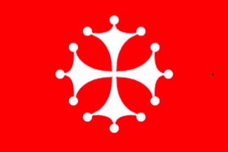
Plain red flag adopted in 1162 and 1166. It was used until
1406. The red flag with white cross is after 1482
Jaume Ollé, 31 October 1998
Pisa Commune, capital of Pisa province, Tuscany, 100.000 inh
Jarig Bakker, 11 September 1999
Above is the flag of Pisa as flown from the leaning tower .
André Serranho, 8 March 2001
 image by Anto'nio Martins, 23 February 2002
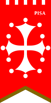
It shows the same pattern as the city flag, the cross a bit
stretched vertically to match the gonfalone. This includes also
the lettering "PISA" on the dexter top.
Anto'nio Martins, 23 February 2002
 image by Anto'nio Martins, 23 February 2002
Plain red flag adopted in 1162 and 1166. It was used until
1406.
Jaume Ollé, 31 October 1998
See also: Tuscany - Historical Flags
 image by Eugene Ipavec, 16 March 2010
The 27th flag mentioned and illustrated in the Book of All
Kingdoms [e9s50] is attributed to
Pisa. This as depicted in the 2005 Spanish illustrated
transcription [e9s05], a plain red
flag, shown in the ogival default shape of this source.
The anonymous author of [e9s50]
describes the flag thusly: "El señor d’ella á por
señales un pendón todo colorado" (And its lord has for
sign a fully red pendon.).
António Martins-Tuválkin, 15 November 2007
 image by Tomislav Todorovic, 19 May 2016
In the Catalan Atlas [c2q75], Pisa is shown
with a plain red flag, as described in the Book of All Kingdoms. The flag is
rectangular, nearly square, with the ending in form of a rounded point with
concave top and bottom edges, a form similar to that of many other flags from
the same source. For unclear reasons, parts of Europe and Africa next to the
right-hand edge of the third leaf of the Atlas (or sixth half-leaf, as is is now
divided) are repeated along the left-hand edge of the fourth leaf (seventh
half-leaf); this includes the northwestern part of Italy, so Pisa and its flag
are shown twice on the map, but the flag shape is drawn as identically at both
places as it was possible to do by hand, both times with the sinister hoist.
Sources:
[1] Catalan Atlas at Wikipedia:
https://en.wikipedia.org/wiki/Catalan_Atlas
[2] Image of Catalan Atlas
at Wikimedia Commons:
https://commons.wikimedia.org/wiki/File:1375_Atlas_Catalan_Abraham_Cresques.jpg
Tomislav Todorovic, 19 May 2016